Another mapping program that utilizes the Google Earth .kml and .kmz data files is NASA's World Wind 1.4 (available free at the link here). I find World Wind of value for the different types of image overlays it provides. A quick example with illustrations will show what I mean.
Let's say that, as before, I am looking for potential gold placer sites. It is a well known truism that the best places to find gold (or any other mineral) are in areas where it has been found before. Turning to the Mineral Resources Data System discussed in the previous post linked above, I fill out the search box, selecting "Washington" for located in, "Gold" for with commodity, and "Placer" for operation type.

Clicking the "Search" button brings up the results screen.
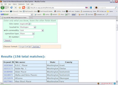
Selecting "Google Earth" in the "Choose format:" drop-down box and clicking the "Get Data" button brings up the data download screen.

I elected to download the .kmz compressed data file although the full size .kml file would work just as well.
With the data file safely tucked away on my hard disk, I open World Wind and go to "File" > "Import KML/KMZ file..." and select the data file I downloaded and saved in the previous steps.
I next navigate to an area that interests me...in this case, Cashmere, Washington, just west of Wenatchee.
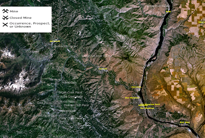
The image above is the basic World Wind view without overlays. As with Google Earth, mineral occurrences are denoted with "X-like" symbols. A couple of differences with Google Earth are that, 1) the name of the mineral occurrence appears next to the symbol, and 2) clicking on a symbol does NOT -- at least on my system -- open an information bubble.
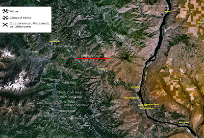
For this example, lets look at the "Wenatchee River Placer" (underlined in red on the image below).
Perhaps the most useful overlay available in World Wind is "USGS Topo Maps." Zooming in on the Wenatchee River Placer and selecting this overlay results in the following image.
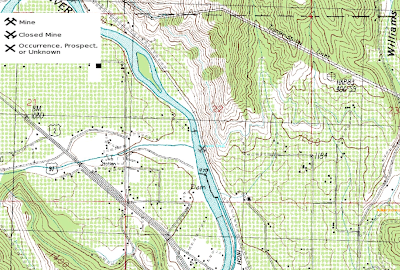
The Topo Map view is useful as it identifies features that are not so easily recognized on the aerial views of Google Earth.
Another World Wind overlay is "USGS Digital Ortho Photos" which, while not as detailed as Google Earth's high resolution color images, may still contain useful information. Below is the same view as the previous one, only with the Ortho Photo overlay enabled.
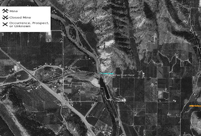
Next is a closer look at the Wenatchee River Placer with the Ortho Photo overlay.
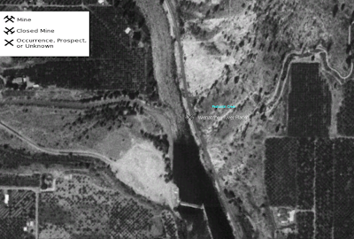
And finally, for comparison, here is the Wenatchee River Placer as seen in Google Earth.

While the Google Earth pictures are more detailed, World Wind displays uniquely useful information via the topographic map overlays. Both of these Earth imaging applications can be combined with the USGS Mineral Resources Data System to identify areas worthy of further study in the search for valuable minerals.
I hope the foregoing posts contribute to both your enjoyment of and success at mineral prospecting.
1 comment:
Nicely Done!
That was east enough to understand.
Ron
Post a Comment