Friday, February 20, 2009

New Geologic Maps Available

There are several new geologic maps available from the Washington Division of Geology and Earth Resources, which agency has supplied the following list:
Geologic Map GM-68. Geologic map of the Camano 7.5-minute quadrangle, Island County, Washington, by Michael Polenz, H. W. Schasse, M. L. Kalk, and B. B. Petersen. 2009. 48 x 36 in. color sheet, scale 1:24,000. (Plotted; $22.18, including shipping and handling. Sold through the Washington Department of Printing. Also available online at http://www.dnr.wa.gov/Publications/ger_gm68_geol_map_camano_24k.pdf [10.1 MB].)

Geologic Map GM-69. Geologic map of the Langley and western part of the Tulalip 7.5-minute quadrangles, Island County, Washington, by H. W. Schasse, M. L. Kalk, B. B. Petersen, and Michael Polenz. 2009. 47 x 36 in. color sheet, scale 1:24,000. (Plotted; $22.18, including shipping and handling. Sold through the Washington Department of Printing. Also available online at http://www.dnr.wa.gov/Publications/ger_gm69_geol_map_langley_24k.pdf [10.1 MB].)

Geologic Map GM-70. Geologic map of the Juniper Beach 7.5-minute quadrangle, Island County, Washington, by H. W. Schasse, M. L. Kalk, and Michael Polenz. 2009. 39 x 36 in. color sheet, scale 1:24,000. (Plotted; $22.18, including shipping and handling. Sold through the Washington Department of Printing. Also available online at http://www.dnr.wa.gov/Publications/ger_gm70_geol_map_juniperbeach_24k.pdf [11.5 MB].)

Geologic Map GM-71. Geologic map of the Olsen Canyon 7.5-minute quadrangle, Lincoln and Stevens Counties, Washington, by R. E. Derkey and M. M. Hamilton. 2009. 42 x 36 in. color sheet, scale 1:24,000. (Plotted; $22.18, including shipping and handling. Sold through the Washington Department of Printing. Also available online at http://www.dnr.wa.gov/Publications/ger_gm71_geol_map_olsencanyon_24k.pdf [14.7 MB].)

Geologic Map GM-72. Geologic map of the Maytown 7.5-minute quadrangle, Thurston County, Washington, by R. L. Logan, T. J. Walsh, B. W. Stanton, and I. Y. Sarikhan. 2009. 42 x 36 in. color sheet, scale 1:24,000. (Plotted; $22.18, including shipping and handling. Sold through the Washington Department of Printing. Also available online at http://www.dnr.wa.gov/Publications/ger_gm72_geol_map_maytown_24k.pdf [30.3 MB].)

Geologic Map GM-73. Geologic map of the North Bend 7.5-minute quadrangle, King County, Washington, with a discussion of the major faults, folds, and basins in the map area, by J. D. Dragovich, T. J. Walsh, M. L. Anderson, Renate Hartog, S. A. DuFrane, Jeff Vervoot, S. A. Williams, Recep Cakir, K. D. Stanton, F. E. Wolff, D. K. Norman, and J. L. Czajkowski. 2009. 38 x 36 in. color sheet, scale 1:24,000, with 39 p. text. (Plotted; $23.48, including shipping and handling. Sold through the Washington Department of Printing. Also available online at http://www.dnr.wa.gov/Publications/ger_gm73_geol_map_northbend_24k.zip [44.7 MB].)
These maps may be either downloaded from the links above or printed copies ordered from the Washington Department of Printing.

For more information on Washington geologic publications, visit the link here.
Wednesday, February 11, 2009

Beach Mining Pilot Program Update

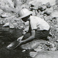
As you may recall from a previous post, last March the governor signed S.B. 6343 establishing a pilot program to allow small scale prospecting and mining on Washington's ocean beaches beginning July 1, 2008.

Thanks to the kindness of Lisa Lantz, Resource Stewardship Manager for the SW Region of Washington State Parks, who supplied a copy of an update report prepared for the Parks Commission on January 22 last, we now have some insight on what has been happening behind the scenes.

According to the report, beginning in May, 2008, State Parks personnel met with WDFW and selected three areas where prospecting would be allowed: "Long Beach – from Ocean Park Ocean Beach Access (OBA) to Klipsan OBA; South Beach – from Bonge OBA to Grayland OBA; and North Beach – from Ocean City OBA to Oyehut OBA."

Subsequently, State Parks received comments that the prospecting areas selected failed to provide freshwater access for miners. As a result, State Parks, in consultation with WDFW, "opened the Iron Springs area, a one-half mile stretch of North Beach, centered on the mouth of Boone Creek," in December.

It should be noted that all participants in the pilot project are required to obtain an HPA from WDFW. Information on applying for an HPA is available from the WDFW web page here. On-line forms and instructions may be found at the One-Stop JARPA Resource Center.

Originally, WDFW limited the equipment miners could use to "motorized pans, non-motorized pans, sluice boxes, mini rocker boxes and non-motorized concentrators." This list was subsequently expanded to include:

Pans; Spiral wheels; Sluices, concentrators, mini rocker boxes, rocker boxes, mini high-bankers with riffle areas totaling 3 square feet or less, including ganged equipment, and high-bankers with riffle areas totaling 10 square feet or less, including ganged equipment; Suction dredges with suction intake nozzle inside diameters no greater than 5-1/4 inches. The inside diameter of the dredge hose attached to the nozzle may be no greater than one inch larger than the suction intake nozzle size; Power sluice/suction dredge combinations with riffle areas totaling 10 square feet or less, including ganged equipment; suction intake nozzle inside diameters no greater than 5-1/4 inches; and pump intake hose inside diameters no greater than 4 inches. The inside diameter of the dredge hose attached to the suction intake nozzle may be no greater than one inch larger than the suction intake nozzle size; and, High-bankers and power sluices with riffle areas totaling 10 square feet or less, including ganged equipment, and pump intake hoses with inside diameters of 4 inches or less.

Furthermore, when miners receive their HPAs, they "also receive maps of the pilot areas and a letter from Parks requesting their cooperation in collecting basic information on the pilot project," including, "where each mining activity occurs, the number of people participating, number of days per activity, quantity of material removed from the beach, type of equipment used, and any difficulties encountered." Miners are also required to "notify WDFW and Parks staff prior to starting work."

According to the report, as of December, 48 people had registered in the North Beach area. The other areas had no reported activity.

For those interested in reading it, the update report for the Parks Commission is available the the link below:

Placer Mining Pilot Program Report.pdf

Monday, February 9, 2009

Radio Program to Discuss Mining Act Tonight

Bruce Beatty, who was one of the stakeholders representing the mining community during the drafting of the forthcoming Gold and Fish Pamphlet (and not to be blamed for the shortcomings thereof!), sends the following information:

This evening 9:00-11:00 PM Central Time: Hal Anthony (host of Behind the Woodshed on RTRRadio.com) is scheduled to be a two hour guest host on Lighting The Fires Of Liberty with host Michael Badnarik.

The show will be focusing on the 1866 Mineral Estate Trust Act/Grant...Understanding its Immense Power, Importance and Availability to all Americans.

http://www.gcnlive.com/Listen_Live.html

Pick a Live Stream on Network 1

P.S. You can contact Mister Anthony for comments, questions, guest appearances, etc @ markonthebeast@yahoo.com

P.S. This is a call in show, so if there are any questions you or others have to the topic, please call and ask. Please pass this info on far and wide.

Given the ugly noises coming out of the current administration and Congress regarding overhaul of the 1872 Mining Law, listening/participating in this broadcast would be a good way to stay informed and educate other listeners.

Thanks, Bruce, for the heads-up.

Monday, February 2, 2009

Ken Salazar on the 1872 Mining Law

I know this is getting old, but I think we need to stay on top of what is going on in the 'other' Washington.

The Q & A with Ken Salazar published at denverpost.com contains the following exchange with the new Interior secretary and former U.S. senator from Colorado regarding reform of the 1872 Mining Law:

The Post: Will you push for reform of the 1872 hard-rock mining law?

Salazar: Any law that has been out there for 136 years and has not been changed needs to be looked at. And in my view, the 1872 mining law is archaic in many ways and needs to be brought into modernity. There are lots of places where the environmental community and the mining community could reach consensus, including issues such as the patenting of public lands and the requirement that fair market value be paid for surface lands that are sometimes now patented as, essentially, giveaways.

The fallacy of "giveaways" of public land through patenting has been addressed so often before on this blog and elsewhere that I won't go into it again. What I find especially disturbing in this exchange, however, is the notion that the 1872 Mining Law needs reforming because it hasn't "been changed" in 136 years. If 'change for the sake of change' is really such a great idea, maybe Mr. Salazar would favor shredding the far older Constitution and Bill of Rights. But, wait! It too often seems that's already been done.