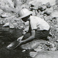
The incident which led up to this radio program was the arrest on September 9 of Gold Hill, Oregon, gold miner Clifford R. Tracy for working his claim in alleged violation of U. S. Forest Service regulations. (See stories here and here.) This incident led to a meeting on September 25 between broadcaster Hal Anthony, David McAllister, President of the Southwest Oregon Miners Association, Ron Gibson, Vice President of the Southwest Oregon Miners Association, and a number of media personnel on the one hand, and Josephine County, Oregon, Sheriff Gil Gilbertson on the other. According to the broadcast report of this meeting, after being shown the 1866 Grant and supporting federal and state laws, Sheriff Gilbertson agreed to instruct his deputies not to interfere with the miners and stated that he could also send a memo to both the BLM and the Forest Service appraising them of this development. The Sheriff promised a copy of this memo to Hal Anthony who stated he will make it available to the mining community once he receives it.
You may listen to this broadcast in two segments by visiting the links below:
Hour 1:http://lamp.
Hour 2: http://lamp.
A resource, courtesy of Hal Anthony's broadcast, which provides more information on this subject is the website Our Backyard. Here one can find, among other treasures, the text of the 1866 mineral estate grant, the wording of which is reflected in the General Mining Law of 1872 (US Code Title 30 Chapter 2), which incorporated provisions of both the 1866 and 1870 mining laws, to wit:
§ 22. Lands open to purchase by citizens
Except as otherwise provided, all valuable mineral deposits in lands belonging to the United States, both surveyed and unsurveyed, shall be free and open to exploration and purchase, and the lands in which they are found to occupation and purchase, by citizens of the United States and those who have declared their intention to become such, under regulations prescribed by law, and according to the local customs or rules of miners in the several mining districts, so far as the same are applicable and not inconsistent with the laws of the United States. (Emphasis added.)
I urge all of you to listen to the entire program and learn as much as possible about our actual rights as miners on the public domain. Moreover, this information needs to be distributed as far and as widely as possible, both within the mining and law enforcement communities, in order that serious misunderstandings may be avoided.
Those having further information or clarifications of this subject are invited to share the same via the "comments" section below this post.
